Original: $12.95
-65%$12.95
$4.53The Story
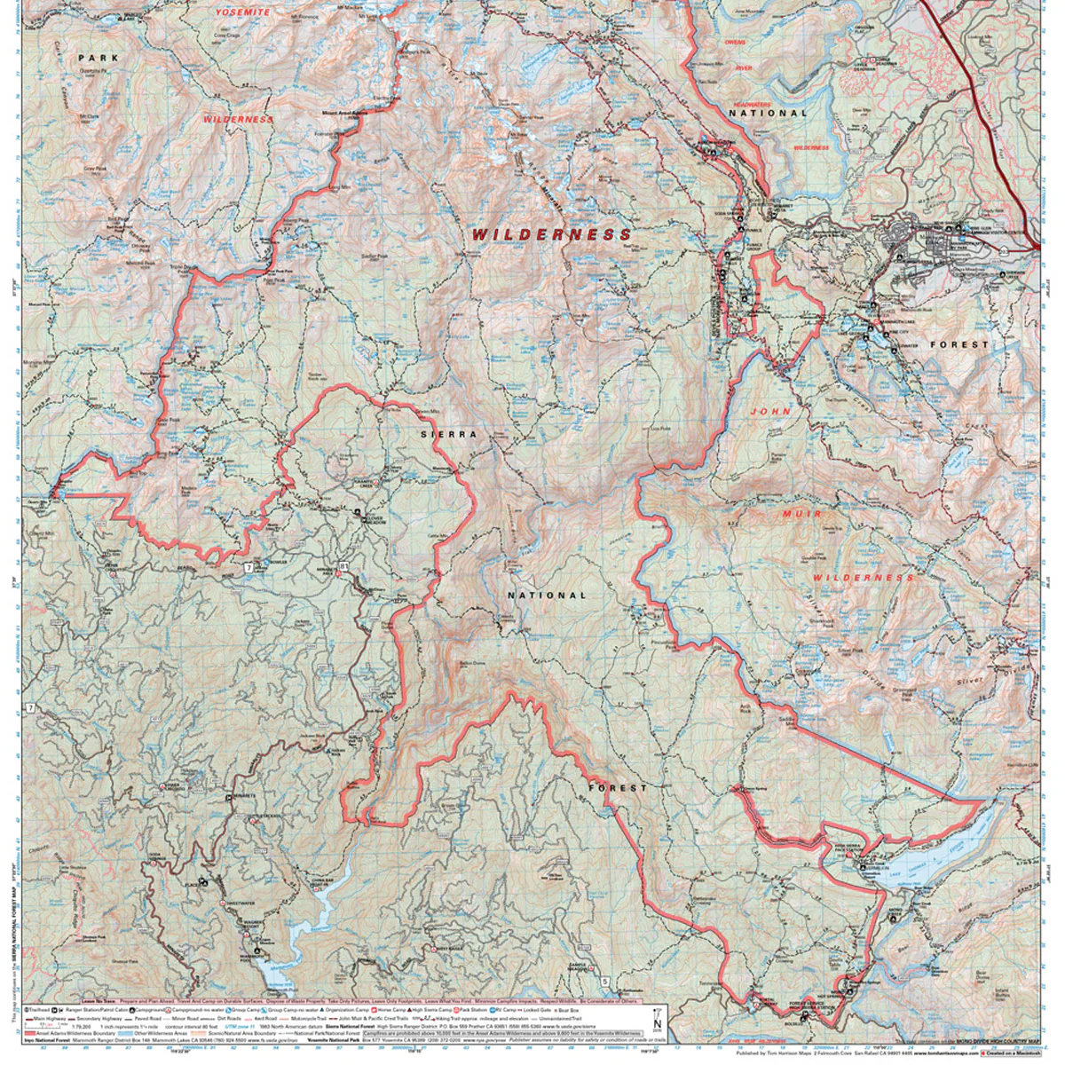
The Ansel Adams Wilderness Map shows complete coverage of this vast wilderness. Covering 232,000 acres, it is split between Sierra and Inyo National Forests. The most popular access points are in the east from Mammoth or June Lake. The west offers remote and lightly used trailheads, as well as a long border with Yosemite National Park. The map shows trailheads, campgrounds, ranger stations, equestrian facilities, bear boxes, forest service roads, trail mileage, elevation points and more.
- Pub. 2020
- Scale 1:79,200
- 80 ft contours
- Water-proof and tear resistant
- Full-color and light-weight
- Shaded-relief topography
- Color-coded symbols and trails
- Mileages between trail junctions
- Latitude/longitude
- UTM grids
- Contour lines
- Vegetation
- Elevations at trail junctions

Details & Craftsmanship
Every detail has been carefully considered to bring you the perfect product.
Details & Craftsmanship
Every detail has been carefully considered to bring you the perfect product.

Details & Craftsmanship
Every detail has been carefully considered to bring you the perfect product.
Description
The Ansel Adams Wilderness Map shows complete coverage of this vast wilderness. Covering 232,000 acres, it is split between Sierra and Inyo National Forests. The most popular access points are in the east from Mammoth or June Lake. The west offers remote and lightly used trailheads, as well as a long border with Yosemite National Park. The map shows trailheads, campgrounds, ranger stations, equestrian facilities, bear boxes, forest service roads, trail mileage, elevation points and more.
- Pub. 2020
- Scale 1:79,200
- 80 ft contours
- Water-proof and tear resistant
- Full-color and light-weight
- Shaded-relief topography
- Color-coded symbols and trails
- Mileages between trail junctions
- Latitude/longitude
- UTM grids
- Contour lines
- Vegetation
- Elevations at trail junctions