Original: $10.95
-65%$10.95
$3.83The Story
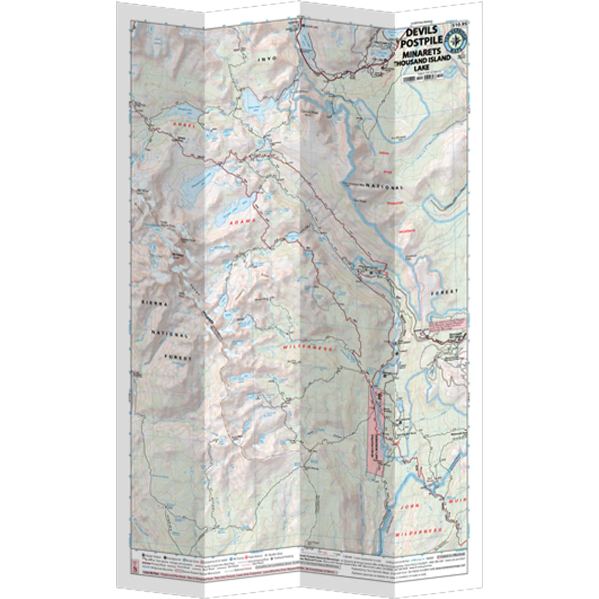
The Devils Postpile and 1000 Island Lake Map shows detailed coverage of this area. There are a large variety of trails and campgrounds. The PCT and JMT run through the middle of this area, including the section where they split. Main access is from Mammoth Lakes or June Lake. The map shows trailheads, campgrounds, ranger stations, equestrian facilities, bear boxes, forest service roads, trail mileage, elevation points and more.
- Pub. 2018
- Scale 1:39,600
- 80 ft contours
- Water-proof and tear resistant
- Full-color and light-weight
- Shaded-relief topography
- Color-coded symbols and trails
- Mileages between trail junctions
- Latitude/longitude
- UTM grids
- Contour lines
- Vegetation
- Elevations at trail junctions

Details & Craftsmanship
Every detail has been carefully considered to bring you the perfect product.

Details & Craftsmanship
Every detail has been carefully considered to bring you the perfect product.

Details & Craftsmanship
Every detail has been carefully considered to bring you the perfect product.
Description
The Devils Postpile and 1000 Island Lake Map shows detailed coverage of this area. There are a large variety of trails and campgrounds. The PCT and JMT run through the middle of this area, including the section where they split. Main access is from Mammoth Lakes or June Lake. The map shows trailheads, campgrounds, ranger stations, equestrian facilities, bear boxes, forest service roads, trail mileage, elevation points and more.
- Pub. 2018
- Scale 1:39,600
- 80 ft contours
- Water-proof and tear resistant
- Full-color and light-weight
- Shaded-relief topography
- Color-coded symbols and trails
- Mileages between trail junctions
- Latitude/longitude
- UTM grids
- Contour lines
- Vegetation
- Elevations at trail junctions