The Story
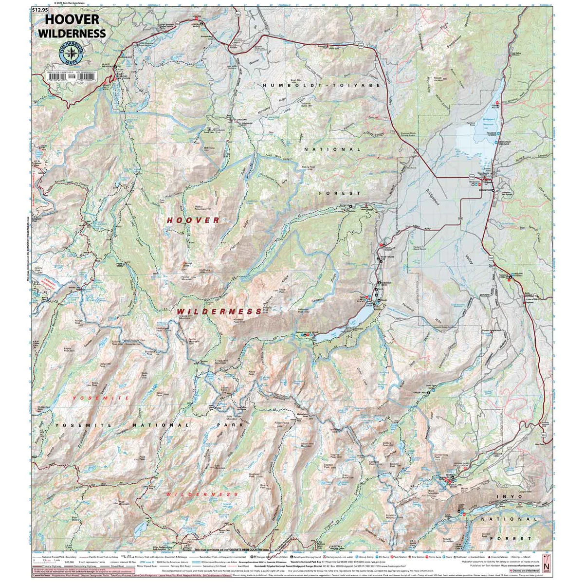
The Hoover Wilderness Map shows complete coverage of the entire wilderness area. Bordered on the south by Yosemite National Park, and on the west by the Emigrant Wilderness. The map shows trailheads, campgrounds, ranger stations, equestrian facilities, forest service roads, trail mileage, elevation points and more.
- Pub. 2025
- Scale 1:63,360
- 80 ft contours
- Water-proof and tear resistant
- Full-color and light-weight
- Shaded-relief topography
- Color-coded symbols and trails
- Mileages between trail junctions
- Latitude/longitude
- UTM grids
- Contour lines
- Vegetation
- Elevations at trail junctions
Details & Craftsmanship
Every detail has been carefully considered to bring you the perfect product.

Details & Craftsmanship
Every detail has been carefully considered to bring you the perfect product.
Description
The Hoover Wilderness Map shows complete coverage of the entire wilderness area. Bordered on the south by Yosemite National Park, and on the west by the Emigrant Wilderness. The map shows trailheads, campgrounds, ranger stations, equestrian facilities, forest service roads, trail mileage, elevation points and more.
- Pub. 2025
- Scale 1:63,360
- 80 ft contours
- Water-proof and tear resistant
- Full-color and light-weight
- Shaded-relief topography
- Color-coded symbols and trails
- Mileages between trail junctions
- Latitude/longitude
- UTM grids
- Contour lines
- Vegetation
- Elevations at trail junctions