Original: $12.95
-65%$12.95
$4.53The Story
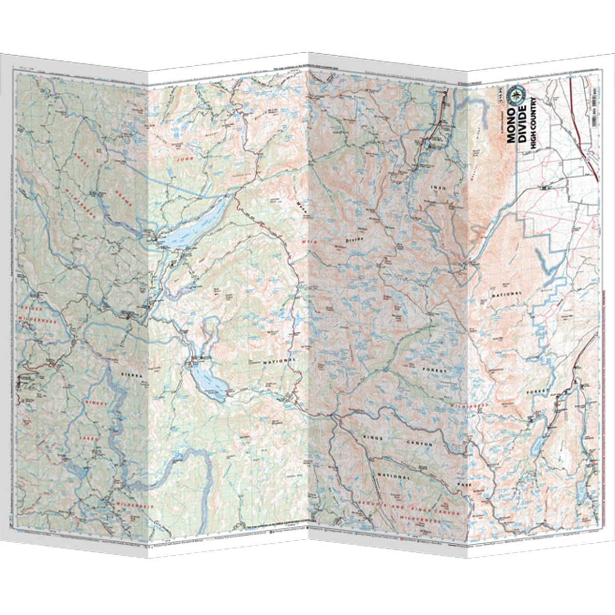
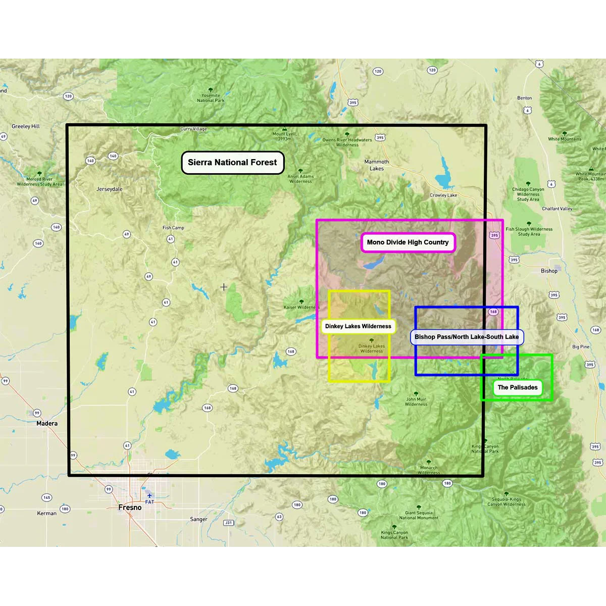
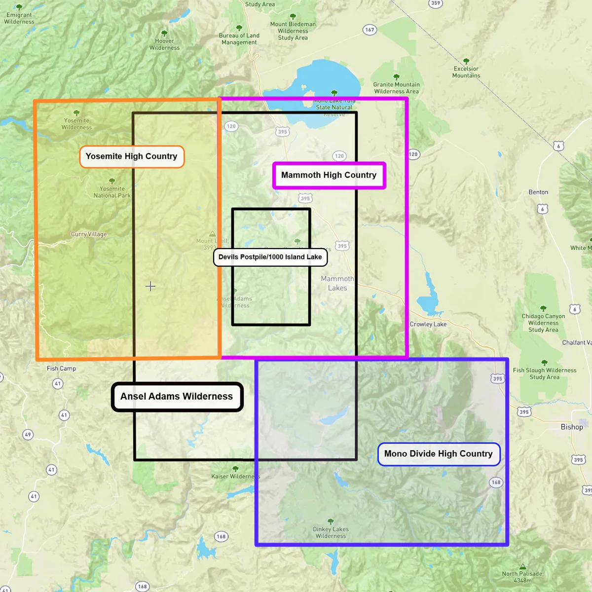
The Mono Divide High Country Map covers the area from Lake Sabrina above Bishop, to the Mono Divide above Rock Creek. This includes the Pacific Crest Trail (PCT/JMT) and much of the John Muir Wilderness and the Ansel Adams Wilderness. The map offers a very readable scale and excellent detail including trail mileage and elevation points. It clearly shows trailheads, campgrounds, ranger stations, equestrian facilities, bear boxes, forest service roads and more.
- Pub. 2022
- Scale 1:63,360
- 80 ft contours
- Water-proof and tear resistant
- Full-color and light-weight
- Shaded-relief topography
- Color-coded symbols and trails
- Mileages between trail junctions
- Latitude/longitude
- UTM grids
- Contour lines
- Vegetation
- Elevations at trail junctions

Details & Craftsmanship
Every detail has been carefully considered to bring you the perfect product.
Details & Craftsmanship
Every detail has been carefully considered to bring you the perfect product.
Details & Craftsmanship
Every detail has been carefully considered to bring you the perfect product.
Description
The Mono Divide High Country Map covers the area from Lake Sabrina above Bishop, to the Mono Divide above Rock Creek. This includes the Pacific Crest Trail (PCT/JMT) and much of the John Muir Wilderness and the Ansel Adams Wilderness. The map offers a very readable scale and excellent detail including trail mileage and elevation points. It clearly shows trailheads, campgrounds, ranger stations, equestrian facilities, bear boxes, forest service roads and more.
- Pub. 2022
- Scale 1:63,360
- 80 ft contours
- Water-proof and tear resistant
- Full-color and light-weight
- Shaded-relief topography
- Color-coded symbols and trails
- Mileages between trail junctions
- Latitude/longitude
- UTM grids
- Contour lines
- Vegetation
- Elevations at trail junctions