Original: $8.95
-65%$8.95
$3.13The Story
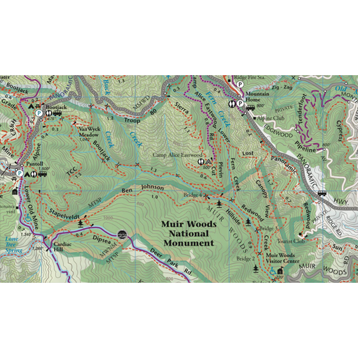
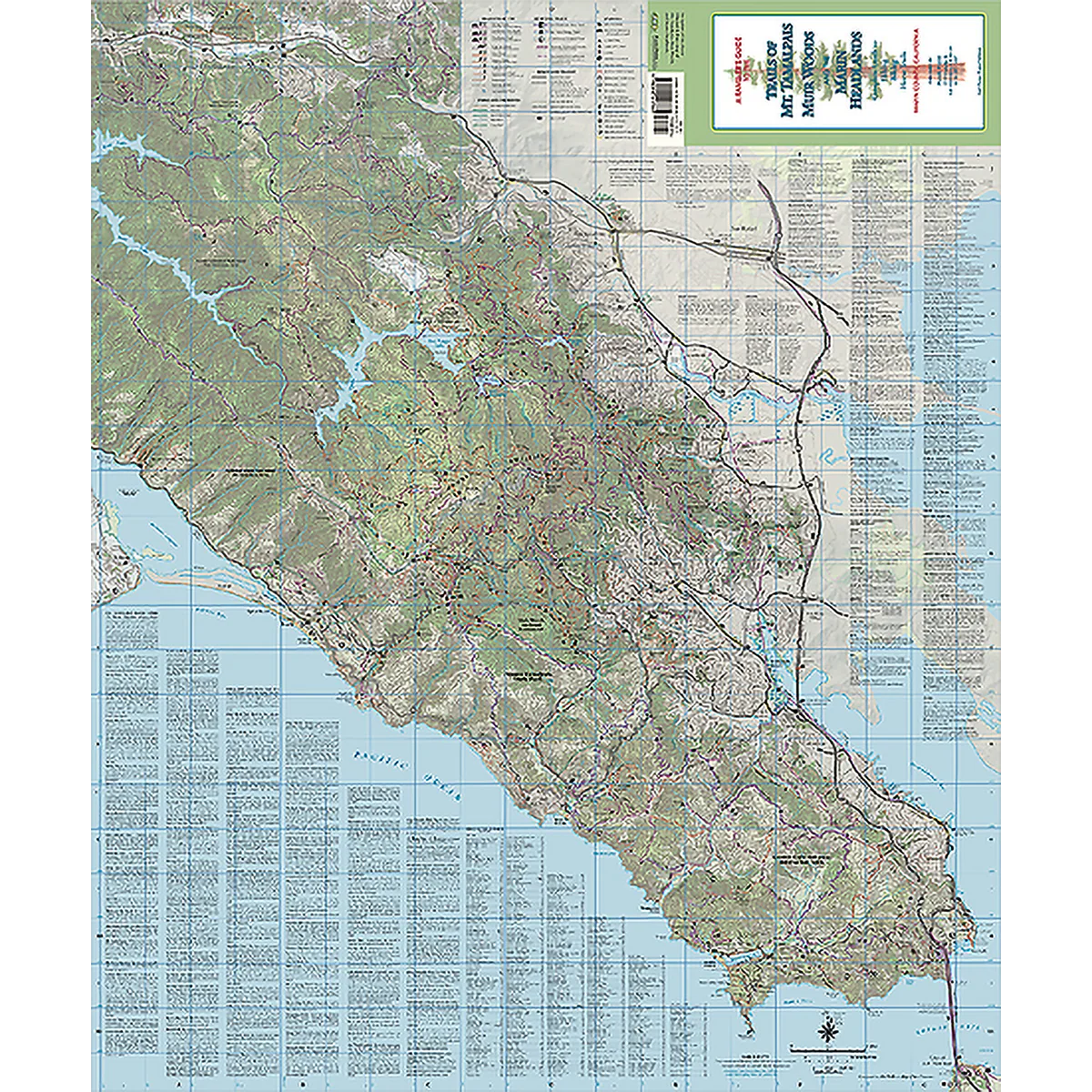
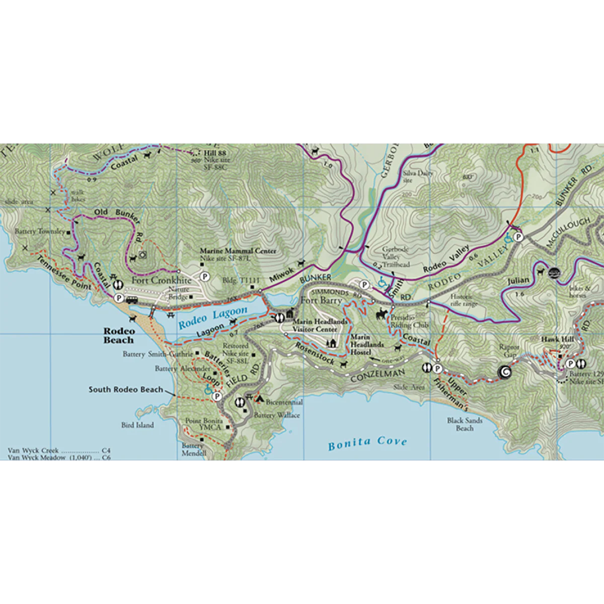
A favorite since 1984, they revived the classic Olmsted map with crisp GPSed trails, purple bike trails, public transit, and surrounding towns. Shows from the Golden Gate to the Mt. Tamalpais Watershed, and now the top edge reaches San Geronimo Valley. A quirky gazeteer from the Mt. Tamalpais History Project tells the origins of 99 place names.
- 2019 2nd (or 12th) edition
- 27 x 36 inches
- Folds to 4 x 9 inches
- Single-sided
- Scale 1:29,770 (2.2 inches = 1 mile)
Details & Craftsmanship
Every detail has been carefully considered to bring you the perfect product.
Details & Craftsmanship
Every detail has been carefully considered to bring you the perfect product.
Details & Craftsmanship
Every detail has been carefully considered to bring you the perfect product.
Description
A favorite since 1984, they revived the classic Olmsted map with crisp GPSed trails, purple bike trails, public transit, and surrounding towns. Shows from the Golden Gate to the Mt. Tamalpais Watershed, and now the top edge reaches San Geronimo Valley. A quirky gazeteer from the Mt. Tamalpais History Project tells the origins of 99 place names.
- 2019 2nd (or 12th) edition
- 27 x 36 inches
- Folds to 4 x 9 inches
- Single-sided
- Scale 1:29,770 (2.2 inches = 1 mile)