Original: $12.95
-65%$12.95
$4.53The Story
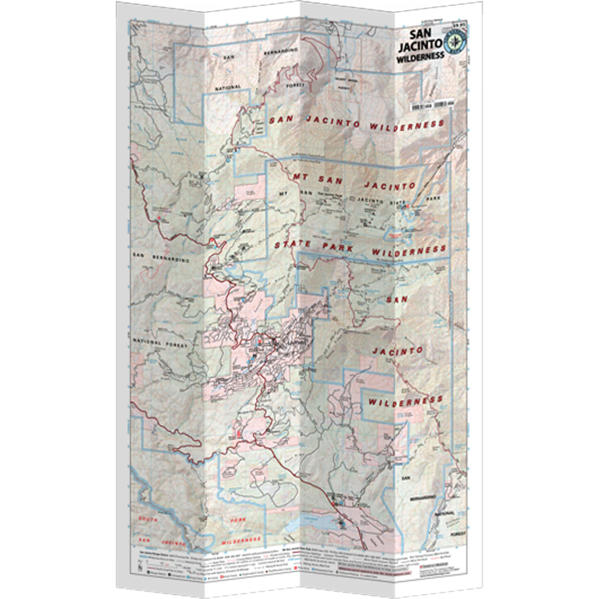
The San Jacinto Wilderness Map shows complete coverage of Mount San Jacinto State Park and the San Jacinto Wilderness (part of the San Bernardino NF). There are a large variety of trails and campgrounds. Shows mileage and elevation points. The town of Idyllwild provides access to trails on the westside, and the Palm Springs Tramway allows quick access from the east.
- Pub 2025
- Scale 1:42,240
- 80 ft contours
- Water-proof and tear resistant
- Full-color and light-weight
- Shaded-relief topography
- Color-coded symbols and trails
- Mileages between trail junctions
- Latitude/longitude
- UTM grids
- Contour lines
- Vegetation
- Elevations at trail junctions

Details & Craftsmanship
Every detail has been carefully considered to bring you the perfect product.

Details & Craftsmanship
Every detail has been carefully considered to bring you the perfect product.
Description
The San Jacinto Wilderness Map shows complete coverage of Mount San Jacinto State Park and the San Jacinto Wilderness (part of the San Bernardino NF). There are a large variety of trails and campgrounds. Shows mileage and elevation points. The town of Idyllwild provides access to trails on the westside, and the Palm Springs Tramway allows quick access from the east.
- Pub 2025
- Scale 1:42,240
- 80 ft contours
- Water-proof and tear resistant
- Full-color and light-weight
- Shaded-relief topography
- Color-coded symbols and trails
- Mileages between trail junctions
- Latitude/longitude
- UTM grids
- Contour lines
- Vegetation
- Elevations at trail junctions