The Story
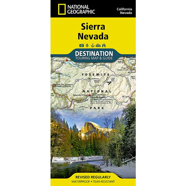
National Geographic's Sierra Nevada Destination Map strikes the perfect balance between map and guidebook and is an ideal resource for touring the rugged landscape of this culturally and geographically unique region of California and Nevada.
The front side of the print map reveals a detailed map of the region stretching from the Oregon border to California's Eldorado National Forest, bordered by the Sacramento Valley to the west and Nevada's Great Basin to the east. Modoc, Shasta-Trinity, Lassen, Plumas, and Humbolt-Toiyabe National Forests are also included on the map. The map features a comprehensive road network including scenic byways as well as areas of interest such as Indian Reservations, National Parks and Monuments, and Recreation Areas. Trails, historic sites, museums, cultural centers, scenic areas, state parks and other points of interest are also included. In addition, the map features beautiful photographs and information on the region's culture, heritage and outdoor adventures.
The reverse side of the map features a detailed map of the area stretching from California's Eldorado National Forest to Sequoia National Forest. Other areas of interest included on the map are Stanislaus, Humbolt-Toiyabe, Sequoia, Sierra, and Inyo National Forests, Yosemite National Park and Wilderness, John Muir Wilderness, Kings Canyon National Park, and Sequoia National Park. In addition, the map includes a chart of the region's National Parks and Monuments as well as travel tips, photographs and information on the natural beauty of the region and its changing landscapes.
- Chart of national parks and monuments highlighting services, recreation opportunities and contact information
- Colorful photographs featuring the region's diverse terrain
- Comprehensive road network, scenic byways, local infrastructure, and abundant natural, historical, and cultural places
- Beautiful photographs and valuable travel information aids travelers with pre-trip planning and on-the-ground adventures
- Every Destination Map is printed on durable synthetic paper, making them waterproof, tear-resistant and tough — capable of withstanding the rigors of any kind of travel.
- Folded Size: 4.25 in c 9.25 in
- Flat Size: 25.5 in x 37.75 in
- Weight: 3oz
- Scale: 1:543,000
- Copyright Date: 2013
- ISBN: 9781597754491
Description
National Geographic's Sierra Nevada Destination Map strikes the perfect balance between map and guidebook and is an ideal resource for touring the rugged landscape of this culturally and geographically unique region of California and Nevada.
The front side of the print map reveals a detailed map of the region stretching from the Oregon border to California's Eldorado National Forest, bordered by the Sacramento Valley to the west and Nevada's Great Basin to the east. Modoc, Shasta-Trinity, Lassen, Plumas, and Humbolt-Toiyabe National Forests are also included on the map. The map features a comprehensive road network including scenic byways as well as areas of interest such as Indian Reservations, National Parks and Monuments, and Recreation Areas. Trails, historic sites, museums, cultural centers, scenic areas, state parks and other points of interest are also included. In addition, the map features beautiful photographs and information on the region's culture, heritage and outdoor adventures.
The reverse side of the map features a detailed map of the area stretching from California's Eldorado National Forest to Sequoia National Forest. Other areas of interest included on the map are Stanislaus, Humbolt-Toiyabe, Sequoia, Sierra, and Inyo National Forests, Yosemite National Park and Wilderness, John Muir Wilderness, Kings Canyon National Park, and Sequoia National Park. In addition, the map includes a chart of the region's National Parks and Monuments as well as travel tips, photographs and information on the natural beauty of the region and its changing landscapes.
- Chart of national parks and monuments highlighting services, recreation opportunities and contact information
- Colorful photographs featuring the region's diverse terrain
- Comprehensive road network, scenic byways, local infrastructure, and abundant natural, historical, and cultural places
- Beautiful photographs and valuable travel information aids travelers with pre-trip planning and on-the-ground adventures
- Every Destination Map is printed on durable synthetic paper, making them waterproof, tear-resistant and tough — capable of withstanding the rigors of any kind of travel.
- Folded Size: 4.25 in c 9.25 in
- Flat Size: 25.5 in x 37.75 in
- Weight: 3oz
- Scale: 1:543,000
- Copyright Date: 2013
- ISBN: 9781597754491